Before you build a house, road, or any other structure, you need to know what’s going on underground. You can’t see it, but what’s beneath the surface (soil, rock, water, even empty spaces) can make or break a project. Subsurface mapping makes this possible, and with today’s geophysical tech, we can now scan the ground faster, better, and without digging things up.
In this article, we explore the latest advances in geophysical methods used for subsurface mapping, their benefits, and how they’re transforming site investigations for engineers, planners, and developers alike.
What is Subsurface Mapping?
Subsurface mapping refers to the process of identifying and visualizing underground conditions, such as soil layers, rock formations, groundwater, faults, and other geologic features. It is essential for:
- Foundation design
- Utility and pipeline placement
- Environmental assessments
- Hazard identification (e.g., sinkholes, voids)
- Infrastructure planning
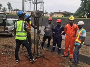
Rather than relying solely on expensive and disruptive drilling, engineers use geophysical investigation methods to gather data through physical signals, like seismic waves, electrical currents, and magnetic fields, to “see” below the surface.
Traditional methods such as boreholes or test pits provide only localized data points. In contrast, geophysical techniques allow for continuous imaging across large areas with minimal ground disturbance. With innovation, these methods are becoming even more precise, faster to deploy, and cost-effective, helping reduce project risk and improve decision-making.
Key Innovations in Subsurface Mapping
Here are some of the most significant innovations that are redefining how engineers approach geophysical investigation.
1. 3D Electrical Resistivity Tomography (ERT)
Electrical Resistivity Tomography involves injecting electrical currents into the ground and measuring the resistance of different subsurface materials. Innovations in 3D ERT allow for detailed three-dimensional models of underground layers. These systems now use multi-channel electrodes and automated switching to collect more data in less time.
3D ERT is especially useful for:
- Detecting buried objects or contamination
- Mapping groundwater tables
- Identifying fault lines and fractures
Its ability to visualize depth and lateral changes makes it a powerful tool for engineers needing high-resolution images of complex subsurface features.
2. Ground Penetrating Radar (GPR)
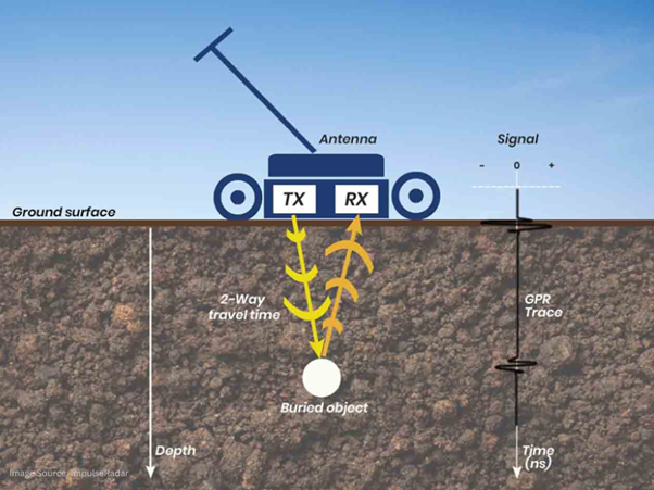
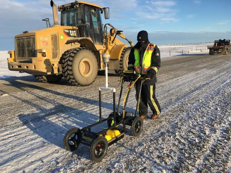
Ground Penetrating Radar (GPR) sends high-frequency radio waves into the ground and detects their reflections. It’s highly effective for shallow subsurface mapping, such as detecting buried utilities, voids, or rebar in concrete.
Recent advancements include:
- Higher frequency antennas for better resolution
- Real-time 3D GPR imaging
- Artificial Intelligence (AI) and machine learning algorithms that interpret GPR signals more accurately, reducing human error
These upgrades mean that GPR systems are now more versatile and easier to interpret, even for non-specialists.
3. Seismic Refraction and Reflection Improvements
Seismic methods use shock waves to determine the physical properties of subsurface layers. Traditional systems required heavy equipment and long setup times. New developments in portable seismic arrays and automated data processing have made seismic refraction and reflection faster and more accessible.
These methods are invaluable for:
- Determining bedrock depth
- Evaluating soil stiffness
- Locating voids or caverns
In areas prone to earthquakes or landslides, improved seismic imaging supports better hazard assessments and foundation design.
4. Magnetometry and EM Induction Enhancements
Magnetometry and Electromagnetic Induction (EM) detect variations in the Earth’s magnetic or electromagnetic field to reveal buried metal objects, underground tanks, or changes in soil composition.
Modern innovations include:
- Drone-mounted sensors for aerial surveys
- High-sensitivity gradiometers for fine-scale mapping
- Real-time GPS-integrated mapping systems
These tools are particularly useful in environmental investigations and archaeological surveys where non-invasive methods are preferred.
5. Integrated Multi-Method Mapping Platforms
Perhaps the most significant innovation is the integration of multiple geophysical techniques into single platforms. These systems combine:
- ERT
- GPR
- Seismic tools
- Magnetics
With centralized software and GPS support, they generate comprehensive subsurface models in a single workflow. This approach minimizes blind spots and improves accuracy across diverse ground conditions.
Benefits of Modern Subsurface Mapping
The innovations above offer a wide range of advantages:
- Improved accuracy in detecting subsurface risks
- Cost and time savings through reduced drilling
- Non-destructive methods that preserve the site
- Better data for design decisions, reducing construction surprises
- Enhanced safety for both workers and future occupants
Modern mapping also aligns with sustainable engineering goals, as it minimizes the environmental footprint of site investigations.
Infrastructure Planning in Urban Zones
Imagine planning a large-scale utility upgrade in a congested city. Using traditional boreholes alone would be disruptive, expensive, and incomplete, but with integrated geophysical mapping, such as GPR, ERT, and magnetometry, you can accurately locate utilities, voids, and underground obstructions without digging a single hole. This level of precision prevents costly delays and ensures smoother project execution.
Thanks to recent innovations in geophysical investigation, engineers now have access to powerful tools that reveal hidden ground conditions with greater clarity than ever before. Whether you’re developing a high-rise, planning a road, or conducting an environmental study, modern mapping methods provide the insights needed to make informed, confident decisions.
Contact AOA Geo-Net for expert subsurface analysis and advanced geophysical support.
