Managing water during and after rainfall is a critical part of planning for urban development, infrastructure, and environmental sustainability. Without proper systems in place, stormwater can cause flooding, erosion, pollution, and damage to both property and natural ecosystems. This is why stormwater management must be backed by detailed hydrology and hydrogeology assessments.
These two fields, while closely related, focus on different but equally important aspects of water behavior. Together, they provide a complete understanding of how stormwater moves on and through the land, which allows engineers, planners, and developers to design safe, efficient, and environmentally sound drainage solutions.
In this article, we’ll explore how hydrology and hydrogeology assessments contribute to effective stormwater management and why these evaluations should never be skipped in any development project.
What Is Stormwater Management?
Stormwater management refers to the strategies and systems used to control the runoff generated by rainfall or snowmelt. In natural landscapes, rainwater infiltrates the ground, replenishing groundwater and feeding rivers and streams at a slow pace. But in developed areas with roads, buildings, and pavements, water can’t soak into the ground as easily. Instead, it flows rapidly over surfaces, picking up pollutants, flooding low areas, and overwhelming drainage systems.
A good stormwater management plan helps:
- Prevent localized flooding
- Reduce pollution entering rivers and lakes
- Recharge groundwater
- Protect infrastructure
- Support sustainable development
To achieve these goals, engineers rely heavily on data and analysis provided by hydrology and hydrogeology assessments.
What Is Hydrology?
Hydrology is the study of how water moves across land. When it comes to stormwater, hydrologists analyze:
- Rainfall intensity and frequency
- Runoff volume and rate
- Drainage patterns
- Watershed boundaries
- Land use and topography
Using tools like rainfall-runoff models (e.g., the EPA’s SWMM tool), hydrologists simulate how water flows over a particular site during different storm scenarios. These models help estimate how much runoff will be generated, how fast it will move, and where it will go.
This information is vital for designing stormwater systems like:
- Detention and retention basins
- Green infrastructure (bioswales, rain gardens)
- Permeable pavements
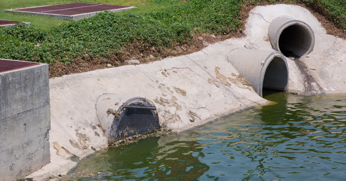
- Culverts and storm drains
By accurately predicting runoff, hydrologists help prevent undersized systems that cause flooding, or oversized systems that waste money and space.
Hydrogeology and Groundwater Behavior in Construction and Environmental Planning
Hydrogeology focuses on how water moves beneath the surface. This includes studying:
- Groundwater levels
- Soil permeability and saturation
- Aquifer characteristics
- Recharge and discharge areas
- Interaction between surface water and groundwater
Hydrogeological assessments are particularly important in areas with:
- High water tables
- Karst terrain (prone to sinkholes)
- Wells or boreholes
- Contaminated soils or groundwater
Engineers need to understand how stormwater will infiltrate the ground, how fast it will move, and whether it could affect underground infrastructure or water quality. For instance, in areas with shallow groundwater, infiltration systems like soakaways could cause waterlogging or basement flooding if not properly designed.
Additionally, hydrogeology helps prevent pollution of drinking water sources by identifying sensitive areas where runoff could carry contaminants into aquifers.
The Importance of Site-Specific Assessments in Stormwater Management
Every site has unique characteristics that influence how stormwater behaves. That’s why hydrology and hydrogeology assessments must be tailored to the project location. Factors like soil type, slope, vegetation, climate, and existing drainage systems all play a role in stormwater planning.
Site investigations may include:
- Soil permeability tests
- Groundwater monitoring wells
- Topographic surveys
- Infiltration rate testing
- Seasonal water level analysis
These assessments provide the data needed to design reliable, low-risk drainage systems that perform year-round.
Combining Green and Grey Infrastructure
Modern stormwater management often uses a mix of traditional (“grey”) infrastructure, like pipes and culverts, and sustainable or “green” solutions that mimic natural processes. Hydrology and hydrogeology assessments support this integration by identifying where each method is most effective.
For example:
- Hydrology can help locate areas prone to high surface runoff, ideal for rain gardens or detention ponds.
- Hydrogeology can guide the placement of infiltration systems in well-draining soils, away from high water tables.
Together, these strategies reduce the volume and speed of runoff, improve water quality, and enhance resilience to climate extremes.
The Importance Of Assessments In Climate Change
Climate change is bringing more frequent and intense rainfall events in many parts of the world. As a result, stormwater systems that once worked well may now be undersized or outdated.
By using up-to-date hydrological and hydrogeological data, engineers can design infrastructure that withstands future storm conditions, not just today’s. This is especially important in urban environments where space is limited and the cost of failure is high.
Planning ahead through robust assessments helps cities and communities adapt more effectively to changing weather patterns and increasing storm intensity.
Effective stormwater management starts with understanding how water behaves, both above and below the ground. Hydrology tells us where the water will flow, and hydrogeology explains what happens when it tries to soak into the earth. Together, they provide the insights needed to design systems that are safe, cost-effective, and environmentally sound.
For reliable hydrology and hydrogeology assessments that support better stormwater solutions, AOA Geo-Net brings the geotechnical expertise your project needs to succeed from the ground up.


