Before embarking on a construction project, one of the most critical steps is understanding the subsurface conditions of your land. This is where a geotechnical site investigation comes in.
A geotechnical site investigation is essentially a comprehensive examination of the subsurface conditions at your proposed construction site. It’s designed to gather data on the soil, rock, and groundwater characteristics, providing engineers with the information necessary to design a safe and stable foundation. This process is far more than just digging a few holes; it’s a systematic approach to understanding the earth beneath your feet.
1. Initial Planning and Desk Study:

The investigation begins with a thorough desk study. This involves reviewing existing geological maps, historical site data, and any previous reports related to the area. Engineers will analyze topographic maps, aerial photographs, and local geology to get a preliminary understanding of the site. This phase helps in planning the subsequent fieldwork and identifying potential hazards or challenges. Expect to see terms like “lithology,” “stratigraphy,” and “groundwater table” in the reports.
2. Site Reconnaissance and Visual Inspection:
Following the desk study, a site reconnaissance is conducted. This involves a physical visit to the site to visually assess the surface conditions. Engineers will look for signs of erosion, slope instability, existing structures, vegetation patterns, and any other relevant features. This step provides a real-world context to the desk study and helps refine the investigation plan.
3. Subsurface Exploration Techniques:
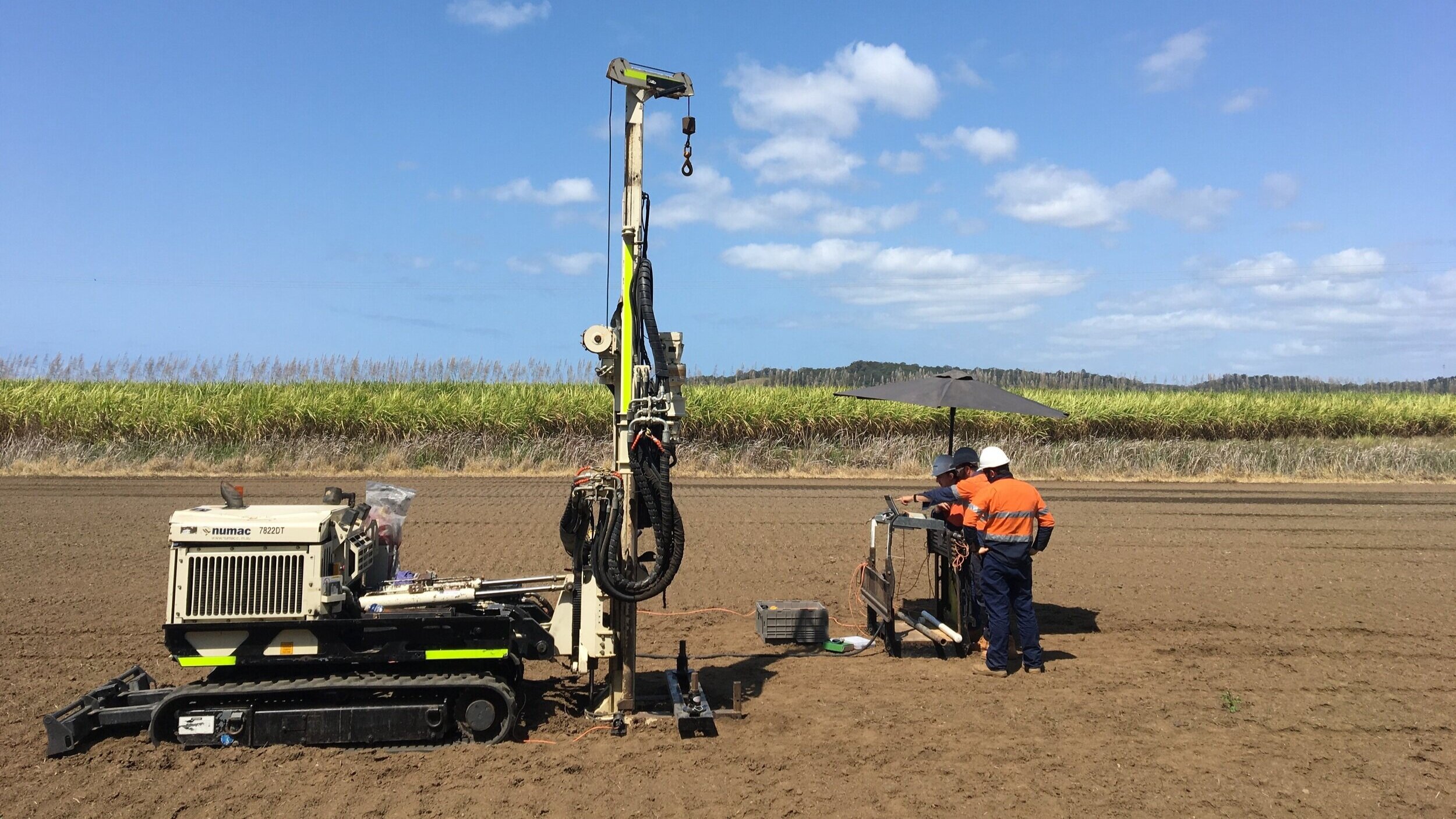
This is where the actual “digging” comes in, but it’s a controlled and scientific process. Common techniques include:
- Drilling: This involves drilling vertical holes into the ground to extract soil and rock samples. The depth and number of boreholes depend on the project’s size and complexity. Expect to see different types of drilling methods like auger drilling, rotary drilling, and core drilling.
- Cone Penetration Testing (CPT): This technique involves pushing a cone-shaped probe into the ground to measure the soil’s resistance. It provides continuous data on soil properties and is particularly useful for identifying soil layers and determining soil strength.
- Test Pits and Trenches: These are excavations made to visually inspect and sample shallow soil layers. They are suitable for shallow foundations and utility installations.
- Geophysical Surveys: These non-invasive techniques use methods like seismic refraction, electrical resistivity, and ground-penetrating radar to map subsurface features. They are useful for identifying bedrock depth, groundwater location, and buried utilities.
4. Soil and Rock Sampling:
During subsurface exploration, soil and rock samples are collected for laboratory testing. Expect to see various sampling methods, including:
- Disturbed Samples: These samples are used for general soil classification and index property testing.
- Undisturbed Samples: These samples are carefully collected to preserve the soil’s natural structure and are used for strength and compressibility testing.
- Rock Cores: These are cylindrical samples of rock extracted from boreholes for detailed rock property analysis.
5. Laboratory Testing:

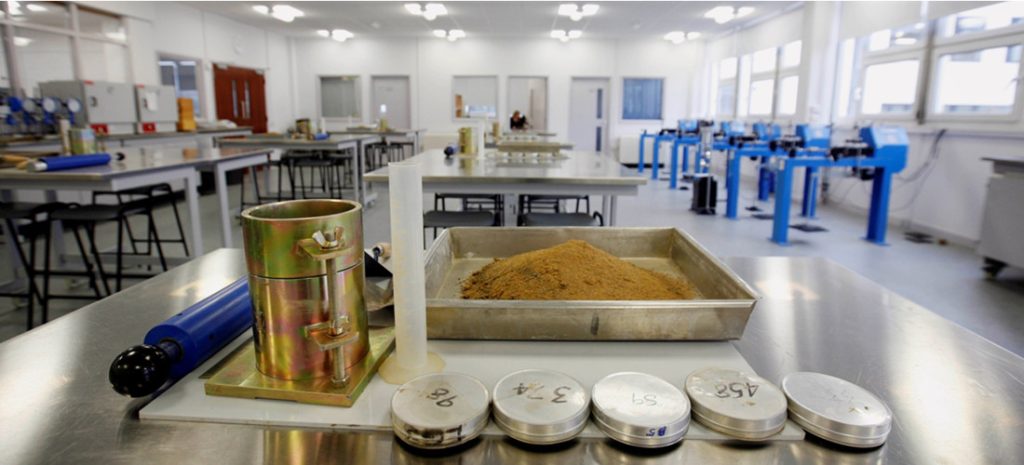
The collected samples are then sent to a geotechnical laboratory for detailed testing. Common tests include:
- Grain Size Analysis: Determines the distribution of particle sizes in the soil.
- Atterberg Limits: Measures the soil’s plasticity and consistency.
- Moisture Content and Density: Determines the soil’s water content and unit weight.
- Shear Strength Tests: Measures the soil’s resistance to shearing forces.
- Consolidation Tests: Determines the soil’s compressibility.
- Permeability Tests: Measures the soil’s ability to transmit water.
- Rock Strength Tests: Measures the rock’s compressive and tensile strength.
6. Groundwater Monitoring:
Groundwater conditions are crucial for foundation design. Expect to see the installation of piezometers or observation wells to monitor groundwater levels and fluctuations. This data is essential for assessing the risk of groundwater-related issues like buoyancy, seepage, and settlement.
7. Geotechnical Report and Recommendations:
The culmination of the geotechnical site investigation is a comprehensive report that summarizes the findings and provides recommendations for foundation design, earthwork, and other construction-related activities. This report will include:
- Detailed descriptions of the subsurface conditions.
- Soil and rock profiles.
- Groundwater data.
- Laboratory test results.
- Analysis of foundation bearing capacity, settlement, and slope stability.
- Recommendations for foundation type, depth, and construction methods.
A well-executed geotechnical site investigation is an investment that pays dividends in the form of reduced construction costs, enhanced safety, and long-term structural integrity.
If you’re seeking a reliable and experienced geotechnical engineering partner, AOA Geo-Net is here to help. We provide comprehensive geotechnical site investigation services, ensuring your project is built on a solid foundation. Our team of experts utilizes cutting-edge techniques and adheres to the highest industry standards, delivering accurate and actionable insights for your construction projects.
Contact us today to get started on your site investigation.


